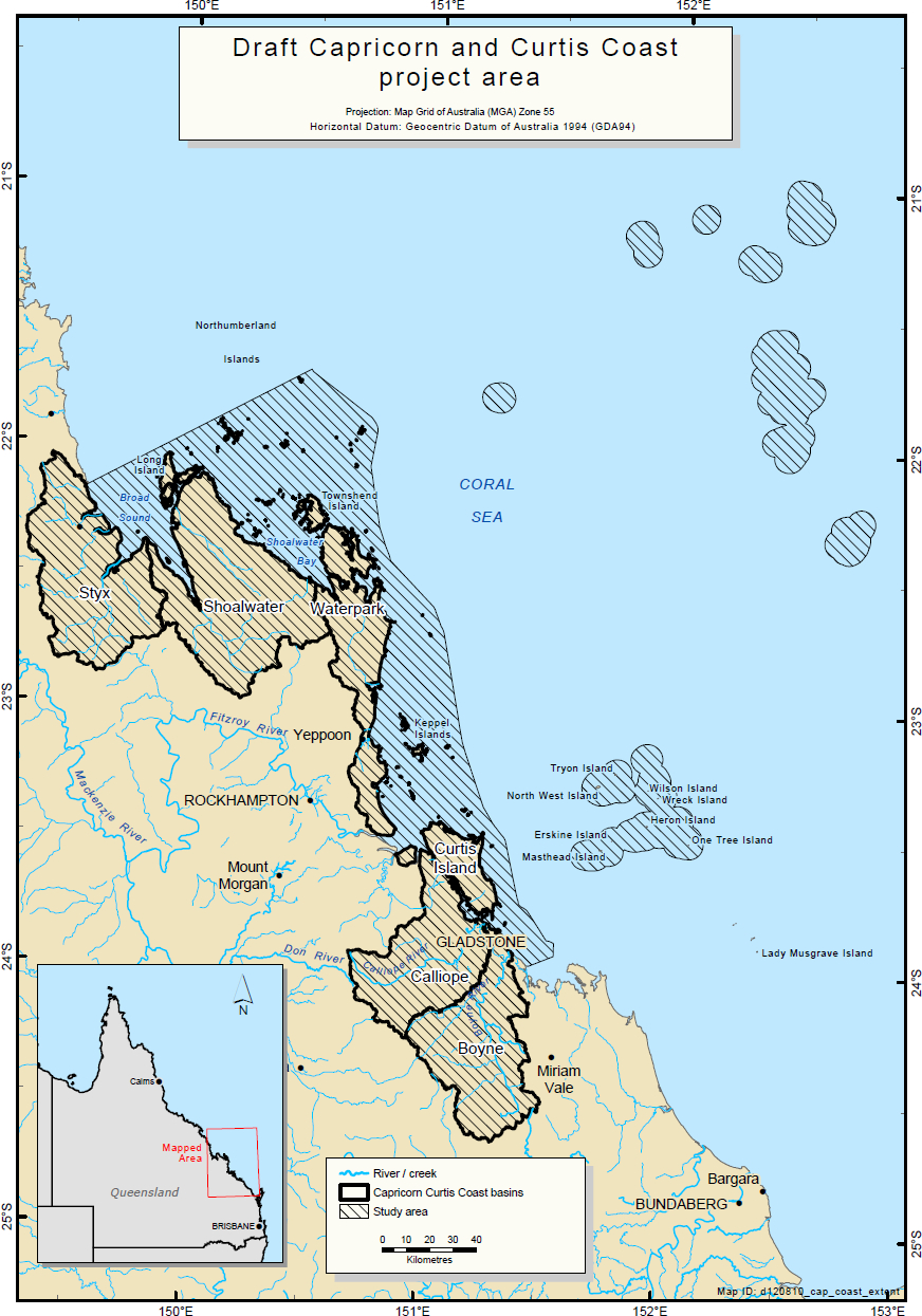
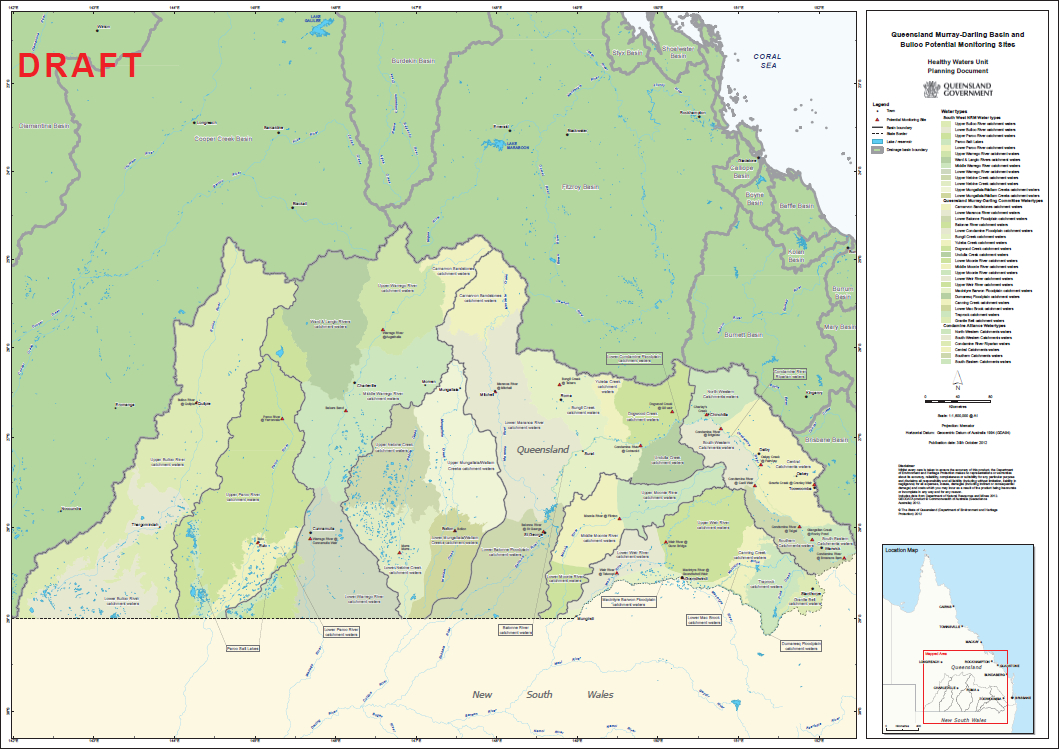
| This is an outline of the project area of one of the projects that my team was working on. It displays the full project area bounded by the thick black line extending out to the islands. It was used in the community consultations to outline the project area. It was also used in the community consultation document. | This is an example of the map used at a community consultation to demonstrate how the natural resource management body managed the area, how the community valued the water and which areas had areas of High Ecological Values. It will also be used as a template to produce the legislative documents at the end of the project. | A Map of the sites used for monitoring in the Queensland Water Quality Monitoring Program 2012-2013. |
 |

|
|
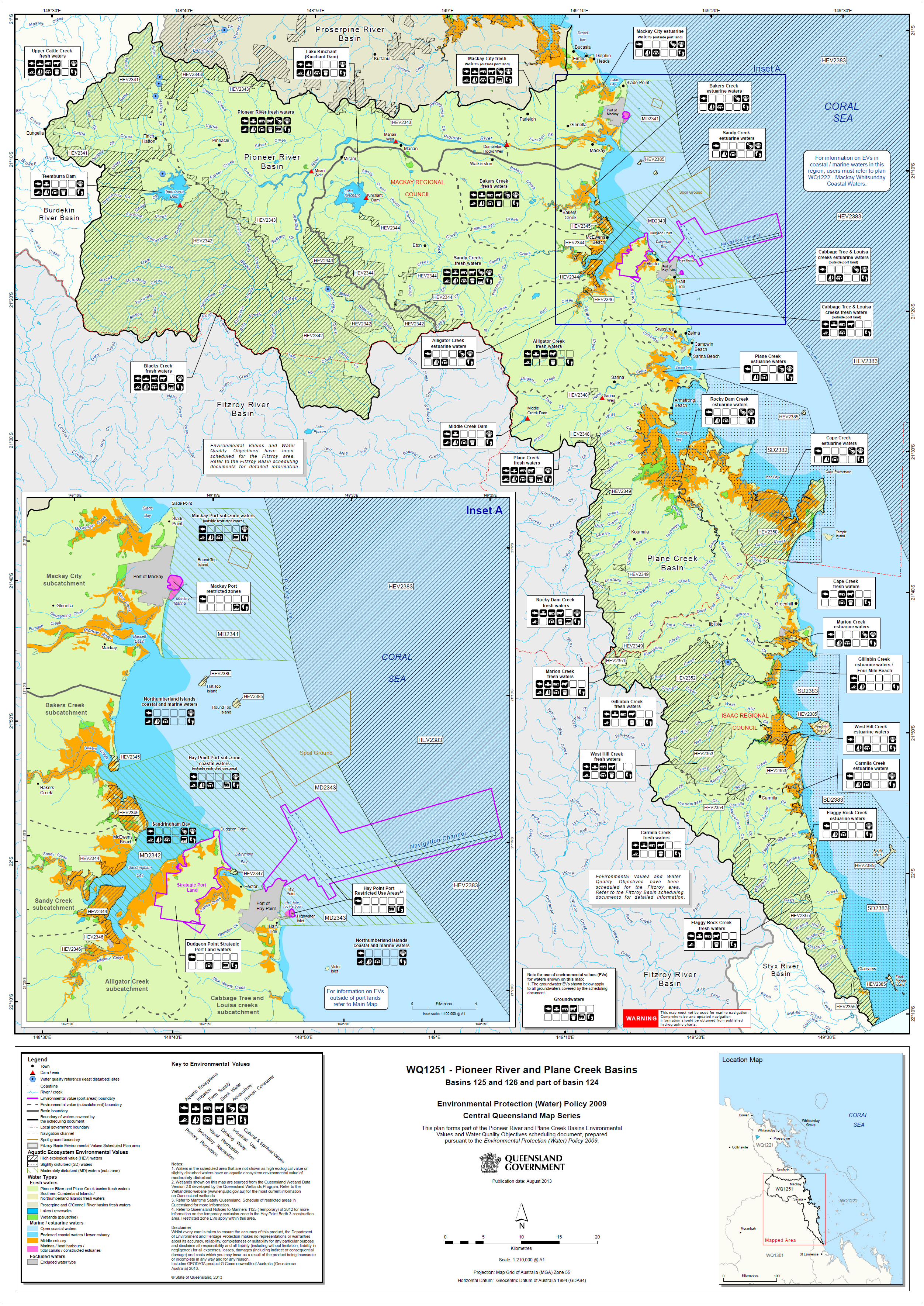
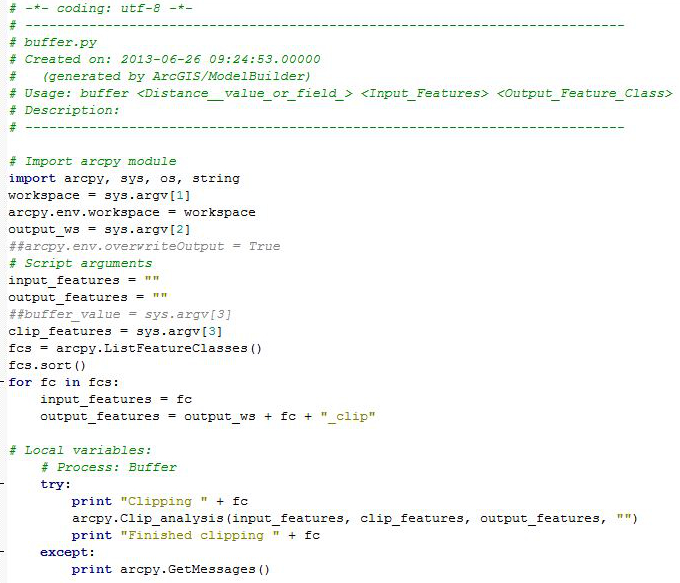
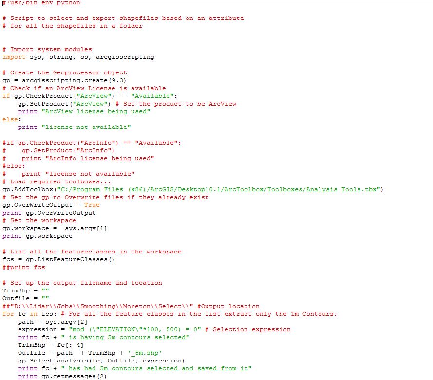
| The final product of the Mackay-Whitsundays High Ecological Values and water types Mapping used in Queensland legislation. I was instrumental in the development of the draft plans. The final plans were developed by other team members upon my departure from the role. | This is an script exported from model builder and is intended to be used in bulk clipping operations. It saves the user time by clipping multiple files to the same outline. For example when starting a project and files need clipping to the project area. | This is an example of the python script used to select 5m contours out of several LiDAR files. Instead of having to select out of each file individually and tediously this script does the selection and exports them to another file with the same file name and a suffix allowing the user to associate that file with the original, but not overwriting that file. |
|
 |
|
Portfolio
Below you will find some examples of the maps and scripts I have created over the years for various work teams.
